|
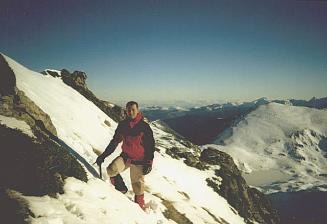
Sommet du Marboré (3200m). Derriere, le cirque de Gavarnie, avec le Taillon, le casque et la Tour. Top of Le Marboré (3200m) on the French-Spain Border. Behind us 2000m below is the famous Cirque de Gavarnie. In the background, the far right peak of Le cirque de Gavarnie called Le taillon. Then (forward the left and toward us) is the Breche de Roland (not very visible from here), Le Casque and La Tour. |
 |
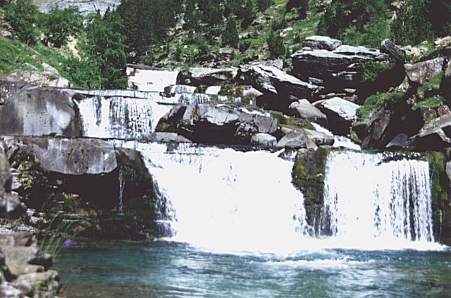 |
Bout du canyon d'Odessa. Ces chutes sont a 3 heures de marche au fond du canyon a partir de l'entrée. This is the end of Odessa canyon. It take about 4 to 5 hours to walk to the very end. These waterfalls are located 3 hours from the entrance (Above Torla, Spain). The bottom of the canyon is not flat but levels when walking to the end. |
|
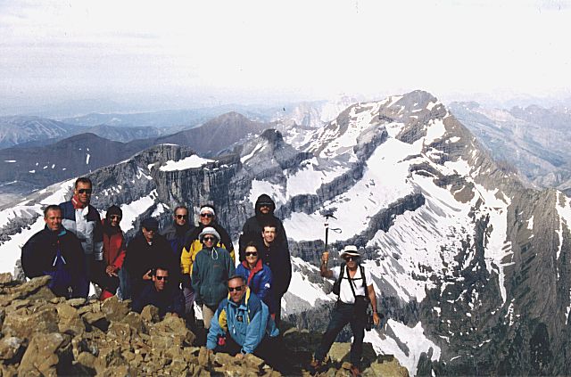
Sommet du Mont Perdu (3355m), troisieme plus haut sommet des Pyrénées. Ici on voit le Vignemale a droite (plus haut sommet en France) This the top of Mont Perdu in Spain (3355m),
the third highest peak in the Pyrénées. In the background, Le Vignemale
can be seen of the right (highest peak in France). |
 |
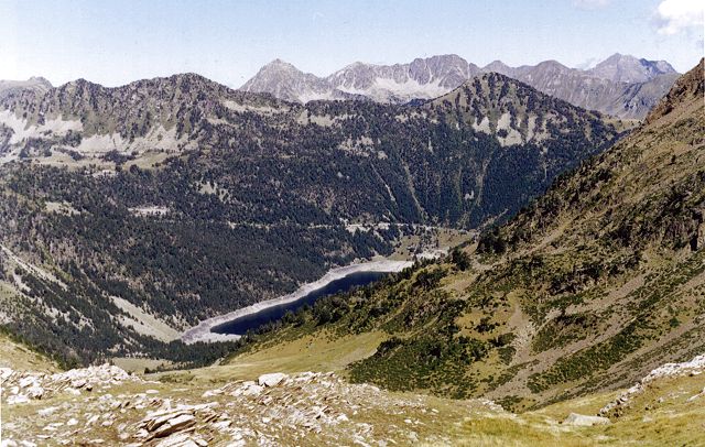 |
Coeur du parc de Neouvielle. The heart of the Néouvielle Park. Various lakes and numerous trails are located in this region of the Pyrenées. It is possible to hike several days and make tours inside the Park. The region is nevertheless more and more crowed due to the popularity and the easiness to get there (roads up to the lakes). |
|
La breche de Roland. This particularity is a big breach in a 50m high and 1km wide wall closing the right up side of Le Cirque de Gavarnie (hardly visible from the village). It is said that Roland cut the rock and did that huge breach with its sword called Durandal. I am standing at the bottom the the breach giving the scale of this geological curiosity. |
 |
Photos de grande resolution autour du Vignemale
Kodak quality pictures around 'Le Vignemale'
(Click and get 512 x 768 pix / 50 to 100 ko)
|
Le cirque de Gavarnie vu du Vignemale. Dans le fond a gauche, on distingue le Marboré dans les nuages. A droite, le Taillon. 'Le cirque de Gavarnie' viewed from the area around 'Le Vignemale'. In the background on the left is the Marbore in the clouds. On the right, the massive Taillon. |
 |
 |
Le Pic de la Sède et la glacier du Vignemale. A ma droite on peut voir le refuge et a gauche, le petit Vignemale. 'Le pic de la Sède' from above the Vignemale Glacier. On the right of my left shoulder you might be able to see the refuge. The peak on the left that seems well below 'Le pic de la Sède' is 'Le petit Vignemale' (the small Vignemale). |
|
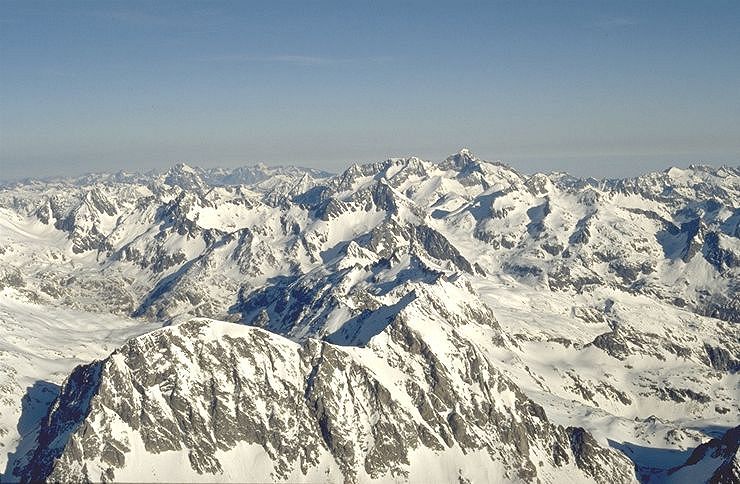
Partie ouest de Pyrénées vu du Vignemale. Wide view of the west part of the Pyrénées from a summit near 'Le Vignemale'. This peak is well above the others. That is why the picture seems to be taken from a high mountain although it is not more than 3300m. |
 |
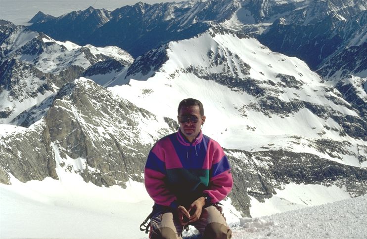
Le Vignemale (3398m) est le plus haut sommet des Pyrénées en France. On peut voir la pente terminale sur la photo de droite.
'Le Vignemale' is the highest mountain in the French part of the Pyrénées. Its altitude is 3398m. I climbed it in spring when not too many people are on the route and when snow allows easy progress towards the summit. I climbed it straight from the glacier just below the summit. At that time, some parts had rock and ice mixed. The slop is visible on the right of the right picture. The left picture is taken at the summit.
 |
 |
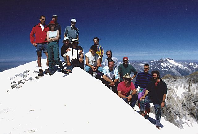
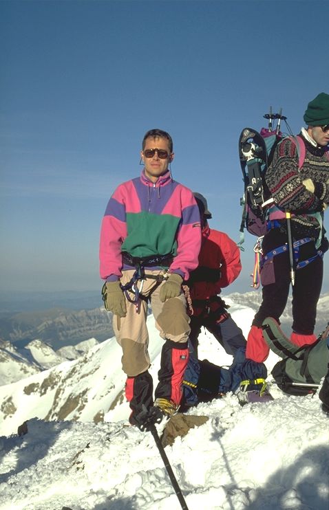
Photo prise de la Tour sur fond de Vignemale. A droite, plus de 2000m de vide...
Below is a picture of the group when I did 'La tour', one of the highest peak of 'Le cirque de Gavarnie' on a windy and cloudy day. It is the peak in the middle of 'Le Cirque de Gavarnie'. In the middle of the picture Le Vignemale is clearly visible. The rock on the snow on the right is actually a limit beyond which it may be dangerous to walk as the snow could collapse and fall 2000m below !

Alpinisme l'hiver et tempete de neige
Winter mountaineering and snow storm !
|
Pres du refuge de Rulhe. Le temps est encore bon a ce moment la... Altitude: 2000m Towards the Rulhe's hut (on the top of the ridge). On the far right, the valley turns and ends with great 100m high ice falls. The weather is still good but... look at the following pictures. Altitude is about 2000m. |
 |
 |
Debut de la construction de l'igloo..., le temps est toujours bon, mais il fait froid. That spot is the right place ! At 2000m high, it is time to build an igloo. The sun is still here but the night might be cold. Carrying snow heavy blocks is not easy and almost one hour is needed to build up the first circle ! |
|
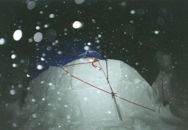
La construction se tranforme en survie avec l'arrivée d'uine tempete de neige, 2h30 plus tard (photo prise en pleine nuit !) Ohhh! Too late. It took us 2 and half hours to builds 3 raws but the night came before we could finish ! The only solution was to put 2 large canvas covers. Hopefully I had several pieces of strings and a 15m long rope because at the beginning of night, a snow storm came ! Real adventure began fixing everything with ice axes, snowshoes and axes. |
 |
 |
Le lendemain matin, photo prise a l'interieur de l'igloo. Il y a 45 cm de neige fraiche au dehors. The next morning is ... white inside the igloo. The wind and snow came inside and covered everything. Outside, 45 cm of fresh snow now surrounds the igloo. It is bad we could not finish it yesterday ! |
|
La tempete est finie. The storm is over. A cold weekend in the mountains is ending... |
 |
 |
Cascades de glace. The mountain is very nice due to recent unspoiled deep snow areas and ice concretions along the way back. That night, the snow fell in the valley at 500m high. |
Coucher de soleil au sommet du Nerass
Sunset on top of Nérass Peak (near Rulhe's Peak) around
8am (Dec 1999)

Sur le chemin de Regalecio
On the way to the summit of Régalecio (Spain border-Dec
1999)